
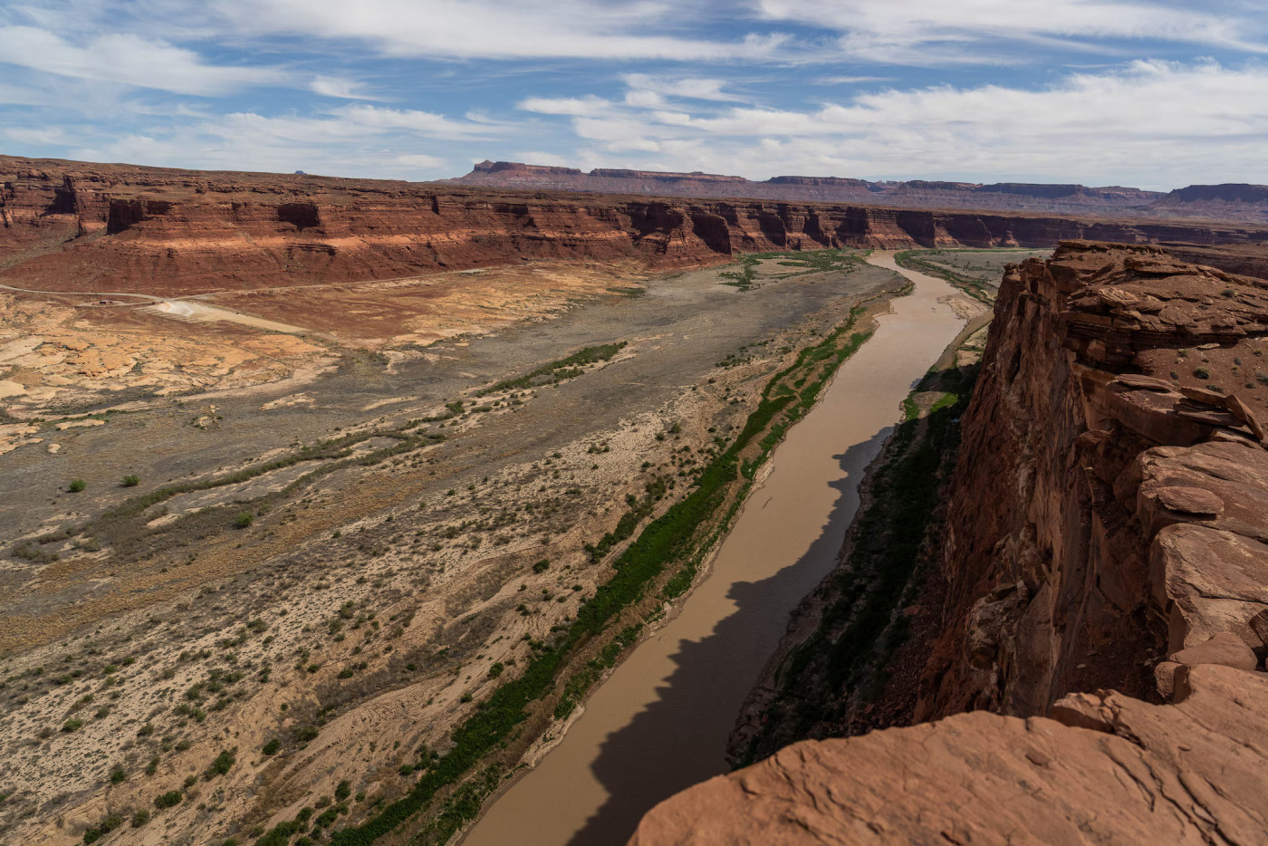
The Bureau of Reclamation released a 10-year framework for managing Lake Powell and Lake Mead, as states continue to negotiate.
The federal government lowers the amount of water it may annually release from Lake Powell, sets a target for water conservation in Utah and other Upper Basin states, and arranges to store up to 3 million acre-feet of conserved water in Powell for future use, under a framework released Friday for how to operate the Colorado River system.
Current guidelines for operating the river system during dry times, which expire this year, said the Bureau of Reclamation would release no less than 6 million acre-feet of water a year from Powell. The new plan drops that floor to 5 million acre-feet.
That will make the system “more responsive to hydrology,” Amy Haas, director of the Colorado River Authority of Utah, said in a media briefing Friday afternoon.
The framework, laid out in the bureau’s final environmental impact statement, includes a water conservation goal for Utah, Colorado, New Mexico and Wyoming of up to 200,000 acre-feet — which is new and voluntary.
The framework includes much greater potential cuts for the Lower Basin states of Arizona, California and Nevada of up to 3 million acre-feet per year.
Those states have proposed to save up to 3.2 million acre-feet through the end of 2028, so the bureau’s plan could nearly double the Lower Basin’s conservation requirements over the next two years.
“We are anxious to be part of the solution,” said Gene Shawcroft, Utah’s Colorado River negotiator. “Even though Mother Nature reduces our ability to use water significantly every year, we believe there are things that we can do in the Upper Basin that would help solve the demand issue, the water supply issue, and we intend to do that.”
Such conservation efforts in the Upper Basin, where Colorado River water flows in smaller tributaries and varies with snowpack, are “extremely complex” and will be developed over the next few years, Shawcroft added. States will likely not meet the 200,000 acre-feet goal for three to five years, he said.
Arizona’s Department of Water Resources called the potential cuts “unacceptable” in a statement on Friday. “Such reductions would devastate Arizona’s water users and its economy,” it said.
An acre-foot equals the amount of water needed to cover an acre of land with a foot of water.
Watch this video on Youtube.
A ‘bridge over no waters’
The seven states that share the Colorado River have not reached consensus on new guidelines. But the bureau, which manages the river’s major reservoirs, needs new plans in place by Oct. 1 — the start of the water year at Lake Powell.
Its new “adaptive decision framework” for managing the Lake Powell and Lake Mead reservoirs over the next ten years explains the agency’s preferred path forward for now. It also allows the bureau to incorporate future consensus agreements, according to a statement from the bureau Friday morning.
“This framework provides the flexibility to respond to changing hydrologic conditions while preserving the opportunity for the Basin States to continue working toward durable, consensus-based solutions,” Interior Secretary Doug Burgum said in the statement.
Gov. Spencer Cox said Interior’s plan provides a “short-term roadmap. ... It does not settle the question.”
“The durable answer still has to come from seven states in one room, agreeing to terms all of them can live with,” the governor said in a statement. “Today’s decision gives us time we didn’t have yesterday, but not much of it. Utah is at the table, and we are ready to negotiate the long-term agreement this river and the people who depend on it require.”
Negotiations between the Upper Basin states and the Lower Basin states have been stuck in stalemates over water conservation commitments and how to manage the reservoirs.
The Arizona Department of Water Resources said the negotiations have been an “exercise in lowering expectations.”
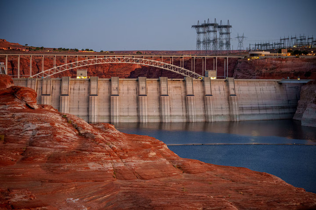
(Trent Nelson | The Salt Lake Tribune) Glen Canyon Dam and high-voltage transmission towers in Page, Ariz. on Tuesday, May 20, 2025.
The bureau’s preferred path forward outlines various “thresholds” and “sidebars” for operating guidelines that will be updated every two years, unless a consensus agreement from the states provides for a longer timeline.
Having a clearer idea of the bureau’s plans may help states in their negotiations, Shawcroft said.
Shawcroft called the document released Friday “a bridge, not a destination.”
“It certainly could be a bridge over troubled waters,” he added, “but perhaps [a] bridge over no waters.”
Here are the operating ranges outlined in the bureau’s plan:
- Annual releases from Lake Powell between 5 million acre-feet and 12 million acre-feet.
- Cuts in the Lower Basin up to 3 million acre-feet.
- Ability to store 3 million acre-feet of conserved water at Lake Powell and 8 million acre-feet at Lake Mead for future use.
- Voluntary water conservation in the Upper Basin up to 200,000 acre-feet.
Lower releases from Lake Powell will help protect Glen Canyon Dam’s ability to produce power and safeguard infrastructure that could be damaged by being exposed to air bubbles when the lake is low.
Lake Powell and Lake Mead, the nation’s two largest reservoirs, have fallen to the lowest combined storage level on record. Powell was 23% full and Mead was 27% full as of July 26, according to the bureau.
“We’re in a dire situation,” Shawcroft said. “We have experienced the lowest snowpack on record, which caused record low volumes of runoff.”
Releases from Flaming Gorge
The framework also includes the “potential for maximum use” of upstream Colorado River reservoirs, including Flaming Gorge, to boost levels at Lake Powell.
During critically dry years, releases could be up to 1.2 million acre-feet, with most water coming from Flaming Gorge, according to the bureau’s models. But most drought-induced releases — which the bureau calls “Powell infrastructure protection releases” — would be 600,000 acre-feet or less, according to the report released Friday.
The bureau and Upper Basin states, including Utah, agreed to release up to 1 million acre-feet of water from Flaming Gorge this year.
Utah and other Upper Basin states have said that such releases are not long-term solutions, though.
Utah wants to make sure it has a say in those releases, said Haas of the Colorado River Authority of Utah. States are currently working with the bureau on a “successor agreement” that will provide more details on how Flaming Gorge and other upstream reservoirs will be operated in the future.
The Colorado River provides water to 40 million people across seven U.S. states, 30 tribal nations and northern Mexico. Climate-change-induced drought has been steadily reducing flows in the river for over two decades.
“This plan strikes a balance between flexibility and predictability for the Colorado River system that is vital to the 40 million people who rely on it given unprecedented hydrologic conditions and the potential for considerable impacts on water users,” said Andrea Travnicek, Interior’s assistant secretary for water and science, in a statement.
The immediate next step is releasing a two-year operating plan that will determine the specific parameters for managing Powell and Mead through 2028.
“This is an important milestone, but it is not the finish line,” JB Hamby, California’s Colorado River negotiator, said in a statement.
Salt Lake Tribune reporter Robert Gehrke contributed to this story.
This article is published through the Colorado River Collaborative, a solutions journalism initiative supported by the Janet Quinney Lawson Institute for Land, Water, and Air at Utah State University.