SALT LAKE CITY — Craig Miller was recently rifling through some old Utah water documents destined to be destroyed when he came across a peculiar set of drawings of the Great Salt Lake sketched nearly 60 years ago.
The document, dated Jan. 15, 1965, outlined a series of dikes, highways and land reclamation projects by Farmington Bay for the ensuing 75 years in an effort to utilize surplus waters from the Bear, Jordan and Weber rivers — at least, that was their intention.
The plans baffled Miller, the hydrology and modeling section manager for the Utah Division of Water Resources.
"They thought the lake was going to dry up and they had to do something, but the something they (designed), oh my gosh, I'm glad they didn't do it," he said, recalling his initial reaction. "There would have been so many negative consequences from what they were attempting to do."
One particular idea, dumping fly ash near the bay, would have created an "environmental disaster" for a large freshwater lake in the area, he explained.
Miller thought he had seen it all when it came to the Great Salt Lake. He joined the division in the 1970s just in time to witness the lake's rising levels force a need to pump water out of the lake to avoid severe flooding. He's since seen the lake slowly dry into a completely different state, to the point where he's listened to ways to pump outside water into the lake.
This set of records, though, was something new. He found it particularly odd because, throughout his career, nobody ever talked about this plan at the water cooler or anywhere else, for that matter.
"I really don't know the history of what they were thinking back then," he said. "(It's) a mystery."
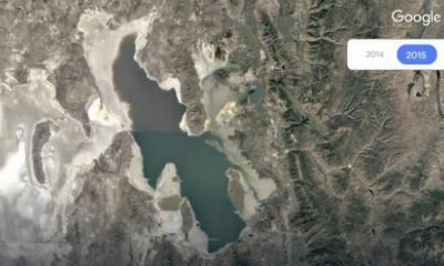
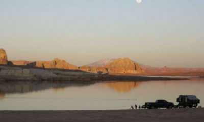
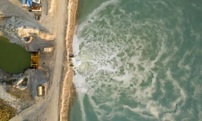
Flash forward to the lake today. The Great Salt Lake continues to make made global headlines because it has reached all-time record lows each of the past two years. Miller figures it will drop to about 4,188.9 feet this month before inflows begin helping the lake slowly rise again this fall and winter. That's 11.5 feet below the average lake elevation over the past 175 years.
Yet the previous record-low — prior to 2021 — didn't come at any other point during the West's two-decade-long megadrought. It actually occurred on Oct. 15, 1963, which likely inspired the plan that Miller serendipitously uncovered.
These designs ultimately say a lot about how knowledge of the Great Salt Lake and its importance to the region have changed over the past few decades. This also explains why there's a stronger reaction to dropping lake levels this time around.
How we got here — twice
Anyone who has lived along the Wasatch Front long enough can tell you about the ebbs and flows of the Great Salt Lake. The first record of the lake's levels was documented in 1843, and levels have been tracked on a regular basis since pioneer settlers reached the Salt Lake Valley in 1847.
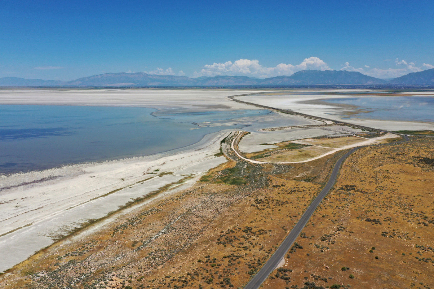
The Great Salt Lake experiences these ups and downs on a fairly regular basis because of how shallow it is. The Utah Division of Water Resources notes that the lake has an average depth of about 14 feet with a maximum depth of 35 feet. That pales in comparison to Crater Lake in Oregon, the nation's deepest lake, which has a depth of 1,943 feet, according to the National Park Service.
Its shallowness explains how levels rose dramatically in the few decades after the pioneers settled. The early settlers arrived to measure the lake's southern arm level close to the 175-year average daily average of about 4,200.4 feet elevation. It rose an additional 10 feet by the 1870s before levels slowly dropped as residents began to divert water from the lake's tributaries, Miller explained.
This steady decline was exacerbated by large droughts in the 1930s and late 1950s. For instance, 1956 remains Utah's second-driest year on record, and 1958 is the 10th-driest, according to federal data. The lake plummeted to a level of 4,191.4 feet by mid-October 1963.
The water rose again, steadily recovering to the 175-year average by the 1970s. Three of Utah's wettest years on record — 1980, 1982 and 1983 — helped propel the lake to a record high of about 4,211.6 feet elevation on June 3, 1986, before the lake began to recede yet again. This time it only took 35 years for it to fall from record high to record low, about 2½ times faster than it took for the record high to low that ended in 1963.
This sudden drop is a mixture of a few things, Miller says.
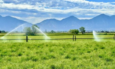
Water diversions upstream of the lake's tributaries are still a major factor, as there isn't enough water reaching the lake as it would have otherwise. Agriculture is the top user but it also doesn't help that Utah's population along the Wasatch Front — Davis, Salt Lake, Utah and Weber counties — nearly quadrupled between the 1960 and 2020 censuses.
There are also managed and unmanaged artificial wetlands that were created when the lake was at a high point and are consuming and evaporating large quantities of water.
The changing climate, such as the two-decade-long megadrought and record-breaking summer heat, is another major component. A series of droughts since 2000 in the American West is considered the region's worst in 1,200 years, while scientists still aren't sure how much the lake evaporates in the summer heat.
"When you have periods of wet weather, you often have other wet years following. When that happens, the lake goes up. Lately, however, we've had huge wet years but then they've been followed by huge dry years, and it seems that they don't make any difference," Miller said. "We haven't had consecutive wet years for quite a while … and we know what happens then: The lake just falls like a rock."
Salt Lake City's past five water years highlight this trend. Four of the past five years — 2018 through 2022 — have fallen below the city's normal of 15.52 inches of precipitation, per National Weather Service data. Though the city received 21.65 inches of precipitation in 2019, over 6 inches above this normal, the collective five years is still 10.37 inches below normal. This exemplifies trends throughout the region, which impact the amount of water that flows into the Great Salt Lake.
This ongoing issue makes it difficult to know when the lake could recover naturally.
Fixing the problem — then and now
In the 1960s, people generally viewed the Great Salt Lake as a sink to the freshwater resources that dump into the lake and thought that water was wasted if it reached the lake, Miller said of the records he can find of the era. This could explain why one Utah congressman asked the Department of Interior to add the Great Salt Lake in an experimental salt water conversion study, as reported by the Deseret News in 1959.
This may also explain why news outlets didn't seem to spend too much time discussing the lake's low levels. There are some reports about receding water levels, but these articles focused on other issues that aren't really a problem anymore.
For instance, one major concern in the 1960s seems to have been the ownership of any newly exposed land when the water recedes. The Salt Lake Tribune reported on Jan. 1, 1965, that Utah's congressional leaders were introducing a bill to give Utah the land rights to the receding lake instead of the federal government.
That's not to say there weren't any conservation efforts at this time.
Frank Moss, one of Utah's senators at the time, continuously pushed for plans in the 1960s to designate the Great Salt Lake as a national park or at least provide it some other form of federal protection — although water quality, not water quantity seemed to be his primary motivator.
Moss explained to his colleagues that the lake was "one of the choice places" to go for anything from picnics to dates at one point before it was steadily turned into a "sewage dump" through mistreatment as it also declined.
"I am most emphatically committed to the proposition that Utah must move in the immediate future to preserve and develop its singular recreational, scenic and scientific attraction that is the Great Salt Lake," he said, addressing a congressional public lands subcommittee in November 1960.
Then there is that strange document Miller recently uncovered. The document seemed to indicate some degree of worry about the lake's decline, though it's unclear how seriously it was taken at the time or why it was shelved, never to be discussed again. It's possible the slowly rising lake levels by the end of the 1960s had something to do with it.
It's a totally different story today as researchers are compiling a better understanding of the lake.
Miller pointed out that there are some records from the past that tried to explain the human impact on the lake levels. However, nearly all of the models that are now used to compile lake health and the impact of low levels were developed either as the lake started to rise again or during its current decline. This research has turned the lake from a relative nuisance to a state priority throughout the span of his career.
Scientists know that higher lake levels can help produce more snowpack via lake effect snow and lower levels can result in dust that depletes snowpack faster. They now know this dust contains dangerous chemicals that are blowing into surrounding communities and can be harmful depending on the dose. The easiest solution to stopping the dust appears to be getting the water back to the lake, said Kevin Perry, a professor of atmospheric science at the University of Utah.
Meanwhile, the value of the Great Salt Lake is growing. Laura Vernon, the Great Salt Lake coordinator for the Utah Division of Forestry, Fire and State Lands says the lake annually contributes $1.3 billion and 7,700 jobs in local economic benefits. It's also a vital stop for an estimated 10 million migratory birds every year, which started to be the case after a new causeway was installed in 1959.
There's a greater concern about the lake now compared to the last time it was this low because of these factors. Utah lawmakers are spending more time addressing the issue, too, this time rooting for fresh water to end up in the lake.
One thing that hasn't changed since the 1960s, in Miller's mind at least, is that not enough Utahns have an appreciation of the lake for what it is.
"It's important because it's a danger now, mostly," he says. "It's also important because ... it has a great deal of economic value that it didn't use to have. Hopefully, someday in the future, we can get some more attention to the lake so it becomes a better resource for our locals."