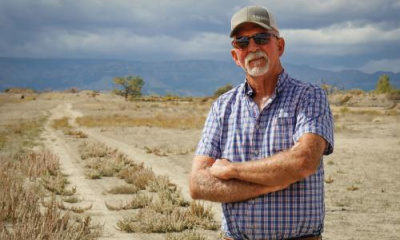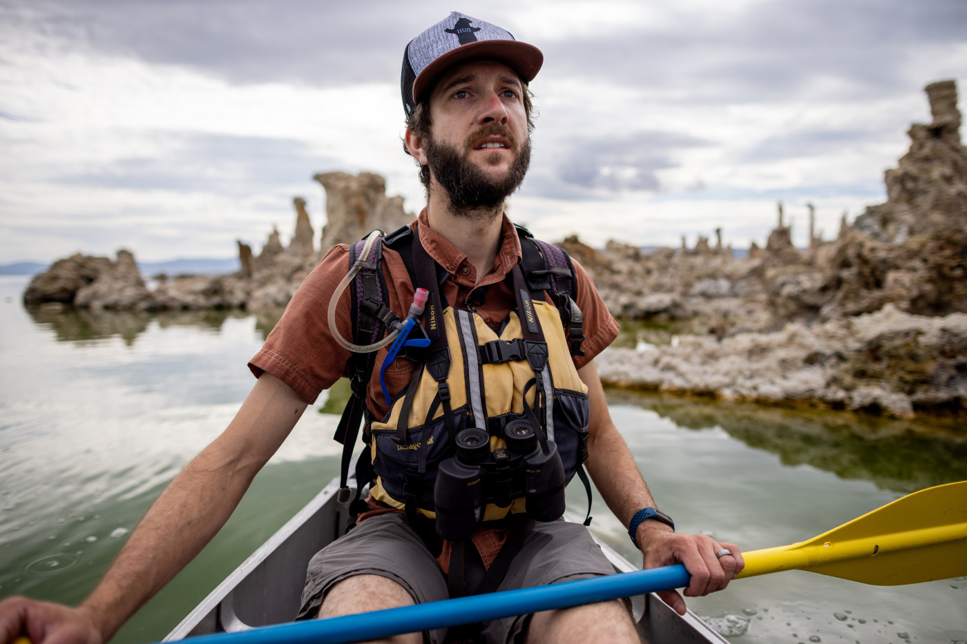
Lee Vining, Calif. • Geoff McQuilkin trekked toward a dam on Lee Vining Creek, fish leaping to catch bugs at a nearby pond, the peaks of Yosemite National Park and the Ansel Adams Wilderness looming in the background.
“Welcome to Los Angeles,” McQuilkin said.
He was only partly joking. Although the megacity lies more than 300 miles south from where McQuilkin stood, its Department of Water and Powerowns hundreds of thousands of acres in the eastern Sierra, land it drained of water rights and sent down the Los Angeles Aqueduct many years ago.
“I can remember coming here, and there'd be no water going over the dam,” said McQuilkin, who works as executive director of the Mono Lake Committee. “That's how it operated for decades. The purpose of these facilities was to capture the full flow of the … tributary streams.”
The city-owned dam on Lee Vining Creek is the aqueduct’s northernmost diversion. At one point, the city funneled away all five of Mono (pronounced “moan-oh”) Lake’s main tributaries, leaving it in peril.
Today, water has returned to the creek’s natural channel below the dam. It flows all the way to the bottom of the basin, its natural destination, helping the lake slowly refill. And it’s due in part to the careful work and monitoring by people like McQuilkin.
Now, “in order to exercise and divert water, you have to make sure there's a minimum flow in the stream,” McQuilkin said. It’s data he regularly checks.
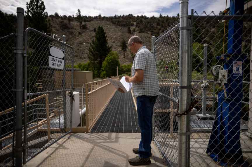
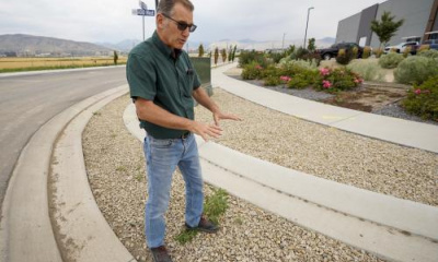
Geoffrey McQuilkin, executive director of the Mono Lake Committee, shows journalists the gates that are used to divert water from Lee Vining Creek to serve Los Angeles on Tuesday, Aug. 9, 2022. Spenser Heaps, Deseret News.
Mono Lake’s advocates successfully argued that protecting natural public resources held equal importance to L.A.’s need to export water to its growing metropolis. It was a painful adjustment for the city’s water providers — used to taking as much as they wanted — but the efforts saved Mono Lake from being drained to dust.
“The story of Mono Lake is one where every drop of water has always mattered,” said Rose Nelson, education director for the Mono Lake Committee, “and every single drop of water will always matter.”
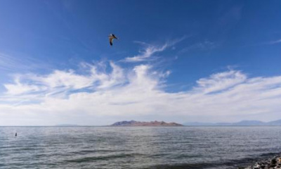
As Utahns confront how to save their own shrinking Great Salt Lake, which is much larger, tapped and drained by far more interests than a single city, McQuilkin said it’s important to think beyond just the body of water.
For these lake protectors, Mono’s health is dependent on the entire ecosystem — from the crest of the Sierra Nevada to the pine forest to the high desert and terminal lake at the bottom, along with all the streams that flow through them.
“We talk about Mono Lake and the unique habitat [found around] salt lakes, the birds, which is all very important,” McQuilkin said. “But actually, in the Great Basin, these stream habitats and their deltas are pretty darn rare, too, used in all kinds of ways.”
He called riparian areas the second piece of the restoration puzzle for imperiled terminal lakes.
Changing attitudes in a much larger basin
The Great Salt Lake’s watershed is massively bigger than that of Mono Lake, and a lot more complex. It drains portions of four states. A network of towns and cities depend on its tributaries, from the rural but rapidly growing Wasatch Back to dense urban centers of the Wasatch Front like Salt Lake City, Ogden and Provo.
Utahns are in the beginning stages of getting a handle on the state of the Great Salt Lake’s 21,000-square-mile catchment area. In their latest general session, state lawmakers adopted and funded the Great Salt Lake Watershed Integrated Assessment, which will explore how much water is available for people and the environment, and investigate ways to improve stream flows during dry seasons.
“Our attitudes about the Great Salt Lake have changed over the decades,” said Todd Stonely, assistant director of planning for the Utah Division of Water Resources. “When I first started at the division, a lot of people were saying any water that makes it to the lake is a waste.”
That notion evolved as the lake began receding, prompting more researchers to study what’s at stake if it dries up.
“We have changed our tune,” Stonely said. “As a state, we’ve recognized it as valuable for lots of things we took for granted previously.”
Although scientists and water managers have collected data on the Great Salt Lake’s elevation, the depth of the mountain snowpack and river flows since around the time Mormon pioneers settled the Salt Lake Valley, the integrated assessment will mark the first time they have combined to understand the bigger picture.
“We’ll be looking to fill data gaps that exist,” said Stonely, whose division is charged with compiling the assessment, “to do additional modeling, to get us the understanding we need to look at the lake holistically.”
Missing pieces include how the groundwater system works around the lake or the amount of inflow making it to the Great Salt Lake proper, Stonely said, including how much water is reaching it from treatment plants.
“A lot of wetland areas managed around the lake receive that wastewater,” he said, “but we’re not sure it actually makes it to the lake.”
The state has decent modeling on most of the major rivers in the watershed, like the Bear, Weber and Provo rivers, allowing experts to forecast how much water is available in each of those basins. But that’s not the case for the urban Jordan River, Stonely said, because its basin doesn’t have many reservoirs, which means less data collected on its tributary streams.
Another big unknown: What toll will climate change take across the Great Salt Lake’s watershed?
“If the trends continue the direction they’re at, there will be less water for the population and the ecosystem near the Great Salt Lake,” Stonely said. “That’s not a good scenario. We should be doing the best we can to prevent that or adapt to it.”
The study will cover one of the largest watersheds ever assessed, he said. Lawmakers earmarked $5 million for the effort, which the division is trying to leverage for more funding from the U.S. Bureau of Reclamation.
The project will likely take years to complete. The final report isn’t due until December 2027.
Stonely said he’s confident the integrated assessment will help policymakers find ways to help the Great Salt Lake recover. But, he acknowledged, the decisions ahead won’t be easy.
“If preserving the lake requires additional water, which seems like an obvious conclusion, where is that water going to come from?” he said. “There will be trade-offs to any of the solutions that are proposed.”
What's your response to At Water's Edge?
Does this reporting project make you feel hopeful? Concerned? Inspired? Surprised?
Selected responses will be used on social media, on our website or in our newsletter.