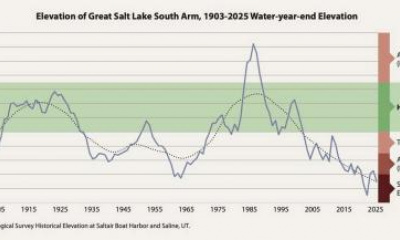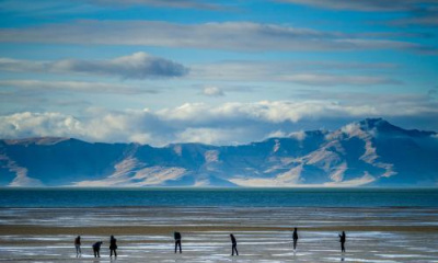
CORINNE, Box Elder County — While the Great Salt Lake's blue southern arm remains much higher than it was this time last year, as it neared its new all-time record low set in early November, the same can't be said about its pinkish northern arm.
Water levels at the U.S. Geological Survey's Saline station — located near Promontory Point just north of the lake's causeway — have fluctuated a tick above and below 4,189 feet elevation in recent weeks, more than 3 feet below the agency's southern arm station near the Great Salt Lake marina and only about a half-foot above its all-time record low set in the fall of 2022.
In fact, Great Salt Lake's northern arm didn't experience as many gains as the southern arm over the past few months. It only topped out at about 4,190 feet elevation in the spring, while the southern arm reached a little higher than 4,194 feet.
So why is it that one section of the lake remains well above last year's elevation and the other is already close to last year's record low?
A tale of two lake arms
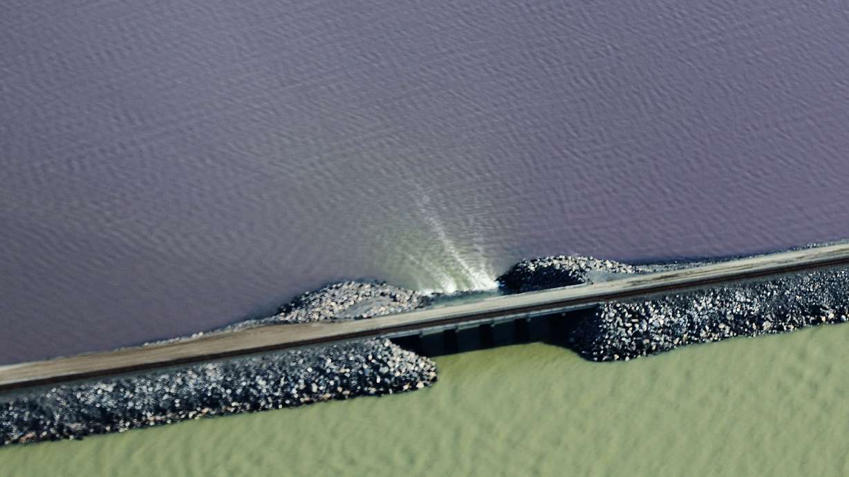
The Great Salt Lake is, as many people know, divided into two arms by a 20-mile railroad causeway that runs through the center of the lake. This has been the case since it was completed in 1959, replacing an old bridge that opened in the early 1900s, as noted by the U.S. Geological Survey. Since most of the water flows into the south arm, there's a 180-foot breach in the causeway that allows water to flow into the northern arm.
But as the lake continued to decline as a result of drought and overconsumption, the much saltier northern arm began to spill over into the southern arm last year.
Ben Stireman, deputy director at the Utah Division of Forestry, Fire and State Lands, explained that salinity levels reached close to a "tipping point" for the lake ecosystem. Raising a berm at this breach ended up being one of the first projects to address this issue, as it essentially sealed off the two arms to prevent the situation from worsening.
This is also the primary reason why the two arms are at completely different water levels right now, Stireman says. The agency helped raise the berm before Utah's record snowpack began to build and then again in February, moving it up to 4,192 feet elevation.
"That had an impact on the water levels of the north arm, but it did help us accomplish our goals of reducing salinity on the south arm," he said, pointing out that it also propelled the southern arm's levels over the spring and early summer. "It reduced the salinity levels considerably ... and, honestly, puts us in a good situation for this next runoff year."
Stireman adds that water is still flowing into the northern arm at a relatively strong rate, but the rate it flows into the lake is about the same rate as consumption and evaporation that are taking water away from this side of the lake.
When adding all of these factors together, the northern arm didn't gain as much water as the southern arm this spring and summer. And even though it hasn't dropped as much as the southern arm over the past few months, this is why the northern arm is much closer to last year's all-time low.
Fixing the northern arm
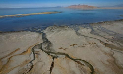
The Great Salt Lake's northern arm remains an important factor in the lake's overall salinity, as long as it's within reason. For example, the Utah Geological Survey writes that not having high enough salinity can impact brine shrimp and mineral production on the lake.
To that end, Utah officials are equally eager to solve the northern arm's woes as the southern arm, it's just the southern arm has more pressing and immediate consequences.
"The north arm is not something we've forgotten about nor have we decided to cut it off," Stireman said, adding that more exposed lakebed by the northern arm is the top concern about that end of the lake right now.
The northern arm, Stireman said, is at a better position for lakebed dust control because it has a "more robust" salt crust that can protect the dust from flying in the air. State land managers have tried to crack down on people illegally driving on the dried lakebed because it can break these natural salt pans, though.
Given all of this, the southern arm will likely continue to be the primary focus in the near future; however, Stireman said the state's ultimate goal is to protect both arms moving forward. That's something that's very much still in progress despite any progress made this year.
"We really want to see this whole entire lake succeed," he said. "Even if the lake were 5 feet higher, this would still be a priority for us because we want to ensure that this is something we're not worried about again in a short time frame."