SALT LAKE CITY — The waters of Great Salt Lake are rising to begin the new year, and experts hope that run will continue after recent storm activity within its basin.
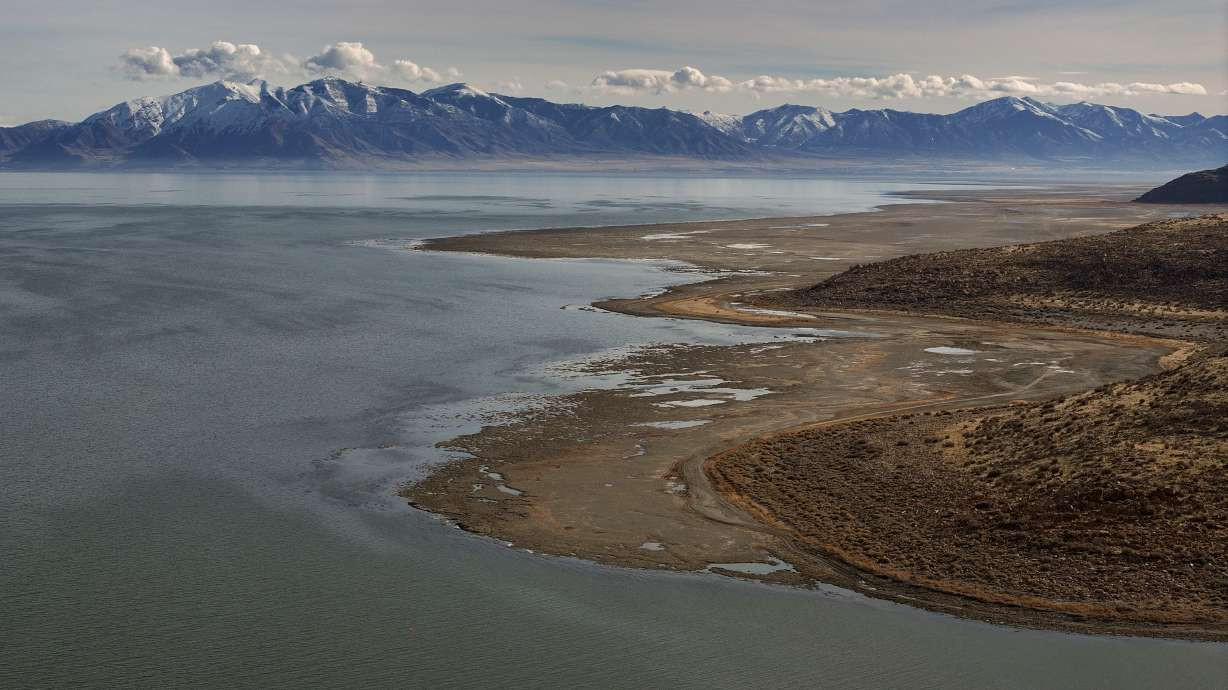
The Great Salt Lake's southern arm continues to flutter near 4,192.5 feet elevation, about a half-foot above a low point in early November, according to U.S. Geological Survey data. Its northern arm is up to 4,191.7 feet elevation, a smaller gain in recent weeks but also up 2 feet from last year because more water is flowing in from the southern arm with a breach between the arms open this winter.
The lake typically rises about 2 feet or so every winter, but subsequently falls about 2 feet every summer. Last year, the lake rose 3 feet, reaching a five-year high of 4,195.2 feet, but a hot, dry summer dropped the lake 3 feet, effectively taking away what looked like progress toward a major drought-driven deficit.
Its recent rise comes after many parts of the Great Salt Lake Basin, covering most of Utah's northern half, have received over an inch of precipitation since Dec. 23. Some mountain areas have gained over 3 feet of snow with more than 5 inches of water within it.
That has helped the lake in two ways, Tim Davis, Utah's deputy Great Salt Lake commissioner, told KSL NewsRadio on Thursday. The low-elevation rain improved tributary flows into the lake, giving it an early boost.
"The lake does get a significant amount of precipitation ... from direct precipitation," he said.
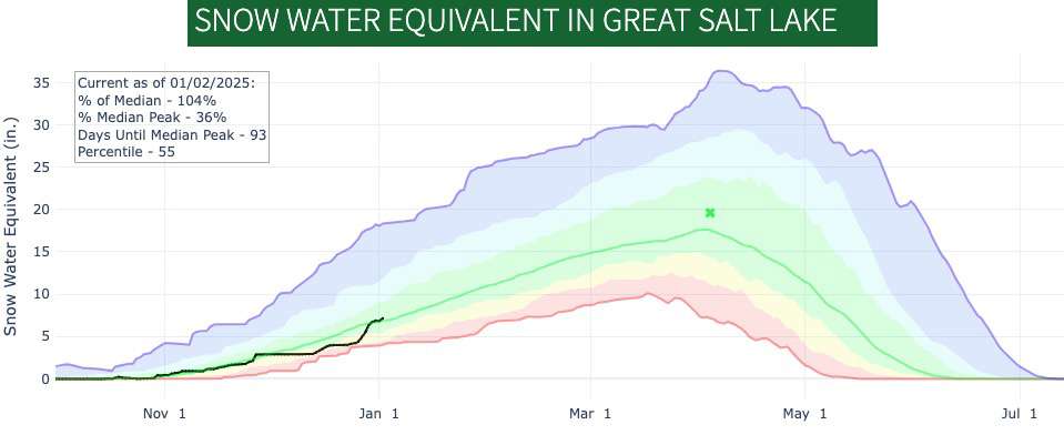
More importantly, it elevates snowpack levels in the mountains above the lake. Those have nearly doubled within the past two weeks, which bodes well for the more impactful spring snowpack runoff. Per Natural Resources Conservation Service data, the basin's snowpack jumped from 4 inches of snow water equivalent on Dec. 23 to 7.2 inches as of Thursday, or 69% of the median average to 104%.

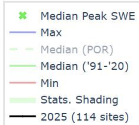
This graph shows snowpack levels within the Great Salt Lake Basin as of Thursday. The basin jumped from about 69% of the median average on Dec. 23 to 104% in less than two weeks. (Photo: Natural Resources Conservation Service) [A key for the graph follows] 
"We basically need an average or better snowpack," Davis said. "We can't control that — that's the challenging thing."
The good news is that long-range forecasts now lean toward that potentially happening.
A wet season ahead?
A more traditional La Niña is to thank for the sudden burst of moisture, Glen Merrill, a hydrologist at the National Weather Service, explained to KSL.com. The oceanic pattern typically sends moisture toward the Pacific Northwest, while drier conditions emerge across the Southwest.
Although Utah is generally caught between the two outcomes, northern Utah also tends to have slightly higher precipitation totals while southern Utah has slightly lower totals during the average La Niña. The past two weeks of storm activity have followed this pattern.
National Weather Service Climate Prediction Center long-range outlooks say the odds favor that trend continuing during the first quarter of the year.
Merrill expects — based on the recent storm track — that more storms will enter Utah from the Pacific Northwest. They might not be as strong or productive as what happened during the last La Niña winter, which set all sorts of records two years ago, but they can keep snowpack levels steady in areas that receive moisture.
"What we're looking at moving forward is a fairly decent frequency of storms coming through ... especially across northern Utah," he said.
That would not just give the Great Salt Lake an early boost, but it could also alleviate drought concerns within the basin. Even after a prolific set of storms, the U.S. Drought Monitor lists nearly all of the basin as still experiencing moderate drought or "abnormally dry" conditions to start 2025.
Wetter soil moisture also creates a more efficient runoff that can boost flows into the lake between now and the start of the next irrigation season.
2025 goals
There's still a long way to go in Utah's snowpack season. The basin's collection so far is only a little more than one-third of its median peak of 19.6 inches of snow water equivalent. However, a normal or better snowpack would likely mean the Great Salt Lake would get another boost from reservoirs within the basin.
Utah's reservoir system entered 2025 at 78% capacity, 20 percentage points ahead of the median average, according to the Utah Division of Water Resources. Several reservoirs within the basin are already at 80% or higher, including Utah Lake at 94% capacity. That means water managers may need to conduct controlled releases into the lake's tributaries yet again to avoid severe flooding this spring.
Meanwhile, Davis said the Office of the Great Salt Lake Commissioner is still working on actions the state can do to help. That includes more planning for water conservation and salinity management on top of any controlled releases in wet years.
"If we get a wet winter, the lake can respond pretty quickly," he said. "Hopefully we get enough snow like we did last year and the year before."


